New Zealand: The South Island
When to go
November to April. The seasons are reversed: December to February is summer, with long evenings and the lupins flowering around Tekapo from late November into December, and mid-December to the end of January are the New Zealand school holidays, when every room in Queenstown is taken. March and April are calm and golden. From June to September Queenstown and Wānaka are ski towns, the Crown Range and the Milford Road can need chains, and the road to Milford may be closed for avalanche risk.
The stops
Interactive map of the route on our site ›
- Christchurch2 nights
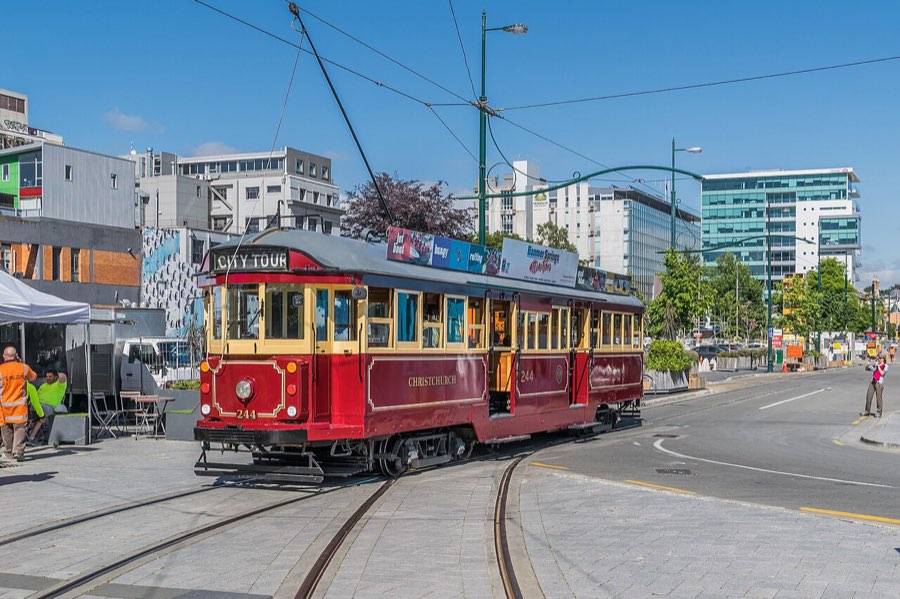
On 22 February 2011 an earthquake killed 185 people here and brought down much of the centre, including the spire of the cathedral. While the old cathedral waited for repair, the Japanese architect Shigeru Ban built a temporary one nearby of cardboard tubes, opened in 2013 and still in use.
- Geraldine NZone night
A country town where the Canterbury Plains meet the foothills, on the way to the Mackenzie Country, named after James FitzGerald, the first superintendent of the province of Canterbury. At the edge of town, Talbot Forest keeps a patch of the native forest of tōtara and kahikatea that once covered the plains.
- Tekapoone night
The lake is milky turquoise from rock flour, stone ground to dust by the glaciers and held in the water. The little stone Church of the Good Shepherd on its shore, built in 1935, has a plain window behind the altar that frames the lake and the mountains, and since 2012 the basin has been an international dark sky reserve, among the best places on Earth to see the stars.
- Lake Pukakistop on the way
A glacial lake of an almost unreal blue, with Aoraki, Mount Cook, at the far end. The road to Mount Cook village runs up its western shore for about fifty-five kilometres and is a dead end, so fill the tank in Tekapo or Twizel before you turn in.
- Aoraki Mount Cook2 nights
The highest mountain in New Zealand, now 3,724 metres: a rock avalanche in 1991 took some ten metres off its summit, and erosion has taken more since. Edmund Hillary trained on these peaks before Everest, and the Hooker Valley Track from the village, about three hours there and back on the flat over three swing bridges, ends at a lake with icebergs under the mountain.
- Omaramaone night
A small crossroads village in the dry tussock basin below the Lindis Pass. The northwest winds that rise over the Southern Alps make it one of the best places in the world for gliding, and it hosted the World Gliding Championships in 1995. Just west of the village the Clay Cliffs, on private land with a small fee at the gate, are pinnacles of gravel and silt carved by erosion.
- Wanaka2 nights
A lake town at the edge of Mount Aspiring National Park, quieter than Queenstown. Lake Wānaka was carved by a glacier and is more than three hundred metres deep, and the willow that grows out of its water west of town, That Wānaka Tree, is among the most photographed trees in the country; the climb up Roys Peak is closed each year from 1 October to 10 November for lambing.
- Arrowtownstop on the way
A gold-rush town that grew up after gold was found in the Arrow River in 1862, with a main street of old wooden and stone shops under trees that turn gold in April. By the river the stone huts of the Chinese miners, who came from the 1860s and were kept apart from the town, have been restored.
- Queenstown3 nights
In 1988 A. J. Hackett opened the first commercial bungy jump in the world from the Kawarau Gorge Suspension Bridge, built in 1880, just outside town, and people still jump there. On Lake Wakatipu the coal-fired steamer TSS Earnslaw, launched in 1912, still carries passengers across to Walter Peak.
- Te Anauone night
The gateway to Fiordland, on the shore of the largest lake of the South Island. The glowworm caves across the lake were known in Māori tradition and found again in 1948 by Lawson Burrows, a local explorer; they are reached only by boat. The Kepler Track, one of the Great Walks, starts at the edge of town.
- Mirror Lakesstop on the way
Small still lakes beside the Milford Road in the Eglinton Valley, where on a calm morning the Earl Mountains are reflected in the water. The sign at the edge of the water is written upside down, so that it reads the right way in the reflection.
- Milford Soundone night
Not a sound but a fiord, carved by glaciers, with Mitre Peak rising straight out of the water and waterfalls on every wall after rain, which falls here on most days of the year. The road reaches it through the Homer Tunnel, cut by hand and with machines through the granite and opened to cars only in 1954. Book the cruise, and the morning boats are calmer.
- Te Anauone night
Back on the lake for the last night. In 1948 Geoffrey Orbell found the takahē, a large flightless bird that had been thought extinct for half a century, in the Murchison Mountains across Lake Te Anau, and the bird sanctuary at the edge of town keeps a few of them.
What it costs
Eighty dollars a night is the room. The car and the fuel are yours, and there are no toll roads on the South Island. Fuel is dearer in the mountain towns than in Christchurch, and there is none at all on the Milford Road between Te Anau and the sound. The extras worth budgeting are the boat cruise on Milford Sound, the night sky tours at Tekapo and whatever Queenstown sells you, from the gondola to the jet boats.
What to know
Three things. One: New Zealand drives on the left, and on an empty mountain road, after a stop at a lookout, it is easy to pull out on the right; say it aloud every time you start, and stop for a break every two hours. Two: your licence. You may drive for up to a year on a foreign licence, but if it is not in English you must carry an International Driving Permit or an approved English translation with it. Three: one-lane bridges, which are everywhere on this route, some of them long; a sign shows who gives way, and the smaller red arrow is the one that waits. And read the rental contract on gravel: most companies exclude cover on certain unsealed roads, such as Skippers Road above Queenstown, and some forbid them outright.
Roads, tolls and rules
New Zealand drives on the left. Outside Christchurch there is no motorway on this route: it is two-lane road all the way, across the Canterbury Plains, over Burkes Pass and the Lindis Pass, and over the Crown Range from Wānaka to Queenstown. Fill up before every pass. The days are kept short, with nights in Geraldine, at Mount Cook village and in Omarama; the one longer day is Queenstown to Te Anau, about 170 kilometres with no town worth stopping in. The Milford Road runs about 120 kilometres from Te Anau through the one-lane Homer Tunnel, so the route sleeps a night at the sound and drives back the next day.

Travel New Zealand: The South Island
The route on our site, with a room up to $80 every night.